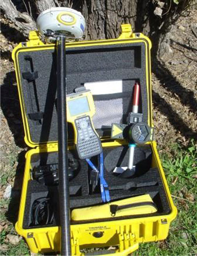
2 double frequence receivers: GPS Total Station R8 GNSS RTK of Trimble, with accuracy± 5mm+0,5 ppm horizontaly and ±5mm+1 ppm in heights, as far as Static and FastStatic Methodology of measuring are concerned. ι
A total station: TCR 805 power of Leica, with accuracy 10 cc, reflectorless up to 400 m.
Software Trimble Geomatic Office and
Leica GeoOffice Tools
HEC-RAS Model (Hydrologic Engineering Center) for river flow simulation (free software)
ODOS8 Software for 3D Analysis and Design of Road Construction and Hydraulic Projects (horizontal alignments, long profiles, cross sections etc).
DIOLKOS8 Software for 3D Analysis and Design of Hydraulic Projects (horizontal alignments, long profiles, cross sections etc.)